
- HOME
 ☆ XXL SALE ☆
- CLOTHING
 -Men's clothing
- Jackets
- Hoodies
- T-shirts
- Thermal underwear
- Shirts
- Vests
- Pants
- Short Pants
- Men's cycling clothing
- Men's overalls
 -Women's clothing
- Jackets
- Sweatshitrs
- Skirt
- T-shirts
- Thermal underwear
- Bras
- Vests
- Pants
- Shorts
- Cycling apparel
 -Clothing - Accessories
- Sunlasses
- Headbands
- Caps
- Baseball caps
- Multifunctional scarves
- Gloves
- Socks
- Impregnation
- Compression sleeves
- Hoods
- Belts
- Raincoats
- Other Accessories
- SHOES
 -MEN'S SHOES
- High hiking boots
- Low hiking shoes
- Running shoes
- Leisure Shoes
- Climbing Shoes
- Fivefingers shoes
- Winter boots
 -WOMEN'S SHOES
- High hiking boots
- Low hiking shoes
- Running shoes
- Leisure Shoes
- Climbing Shoes
- Women's Fivefingers shoes
- Winter shoes
 -ACCESSORIES
- Impregnation
- Gaiters
- Anti-slip crampons
- Shoelaces
- Shoe insoles
 -Men's shoes sale
 -Women's shoes sale
- SPORTS
 -Climbing
- Ascenders
- Crash pads
- Ice Axes
- Quickdraws
- Nuts & climbing friends
- Belay devices
- Carabiners
- Pulleys
- Ropes
- Climbing sets
- Climbing Shoes
- Crampons
- Chalk & chalk bags
- Clothing
- Anchors & bolts
- Technical climbing gear
- Helmets
- Slackline
- Loops
- Ice screws
- Training boards
- Harnesses
- Rope bags
- Descender brakes
- ...show all
 -Via Ferrata
- Sets
- Kids via ferrata equipment
- Carabiners
- Shoes
- Helmets
- Gloves
- Damper falls
- Harnesses
- ...view all
 -Hiking
- Hiking shoes
- Clothing
- Backpacks
- Ice axes
- Travel first aid kits
- Water filtration
- Bottles
- Strike igniters
- Heaters and warm patches
- Anti-slip crampons
- Snowshoes
- Food and nutrition
- Vacuum flasks
- Hiking maps
- Hiking guides
- Hiking Gaiters
- Trekking poles
- Survival gear
- Accessories
- ...view all
 -Camping
- Tents
- Sleeping bags
- Sleeping pads
- Hammocks
- Cartridges
- Spice jars
- Camping Furniture
- Camping Cookware
- The mosquito
- Protective creams
- Cutlery
- Repellents
- Cookers
- Camping preferred sets
- ...view all
 -Running
- Running shoes
- Clothing for runners
- Running gear
- Drinks and gels
 -Ski Touring
- Sets
- Skis
- Boots
- Skins
- Bindings
- Avalanche safety
- Clothing
- Backpacks
- Poles
- Gear
- Equipment
- Accessories
- ...view all
- EQUIPMENT
 -Baby carriers
- Carriers up to 20 kg
- Carriers up to 22 kg
- Accessories
- Bargain Sets
 -Backpacks
- Small Backpacks to 29 l
- Medium backpacks 30 - 55 l
- Large backpacks 55-90 l
- Hydration systems
- Pouches
- Waistpacks
- Wallets
- Raincovers
- Dry bags & waterproof cases
- ...view all
 -Light sources
- Headlamps
- Flashlights
- Accessories
 -Tents
- For 1-2 persons
- For 3-4 persons
- For 4 and more persons
- Cotton
- Expedition
- Waterproof
- Party tents
- Beach
- Shelters
- Festival
- For motorcyclists
- Ultralight
- Tent accessories
- ...view All
 -Sleeping bags
- Kids
- Summer
- Three-season
- Winter
- Bivy bags
- Rectangular
- Small and lightweight
- Down
- By temperature limit
- Accessories
- ...view All
 -Sleeping pads
- Foam
- Self inflatable
- Inflatable
- Air mattresses
- Accessories
 -Work & safety gear
- Work at height equipment
- Arboriculture
- Rescue work
- Armed forces
- Rope parks
- ...view all
 -Tools
- Knives
- Gerber knives
- Machetes
- Multifunction Tools
- Saws
- Axes
- Work & safety gear
 -Work at height equipment
- Ascenders
- Headlamps
- Carabiners
- Anchoring devices
- Pulleys
- Lanyards
- Harnesses
- Helmets
- Positioning devices
- Loops
- Static ropes
- Fall arresters
- Descender brakes
- Qccessories
 -Arboriculture
- Descenders
- Harnesses
- Pulleys
- Installing the rope in the tree
- Lanyards for tree care work
- Accessories
 -Rescue work
- Rescue systems
- Rescue and transport equipment
- Stretchers
 -Armed forces
- Harnesses
- Ropes
- Helmets
- Pulleys
- Ascenders
- Carbines
- Descender brakes
 -Rope parks
- Full-body harnesses
- Pulleys
- Helmets
- SPECIAL OFFER
- BRANDS
- Acron
- Adam Sports
- Adidas
- Adventure Menu
- Asics
- Alpina
- Alpinverlag
- Aku
- Atomic
- Asolo
- Black Crows
- Black Diamond
- Baladeo
- Beal
- Benesport
- BioLite
- Bollé
- Bridgedale
- Brynje
- Buff
- Camelbak
- Camp
- Campingaz
- Care Plus
- Cassin
- Chimpanzee
- Cober
- Coghlans
- Coleman
- Contour
- Converse
- Corazon
- Crazy Idea
- Dajama
- Deuter
- Devold
- Diamir
- Directalpine
- Dolomite
- Dromader
- Dynafit
- Easy Camp
- Edelrid
- Eisbär
- ELAN
- Esbit
- Fenix
- Ferrino
- Fischer
- Fiskars
- Freytag Berndt
- G3
- Garmin
- Garmont
- Gecko
- Gerber
- Gipron
- GoPro
- Granger's
- Grivel
- GSI Outdoors
- Hagan
- Hanwag
- Heatpaxx
- High Point
- Husky
- Injinji
- Inov-8
- Jetboil
- Julbo
- Kohla
- Komperdell
- Kreuzspitze
- La Sportiva
- Lasting
- Leatherman
- Led Lenser
- Leki
- Lifesystems
- Lifeventure
- Light my fire
- LittleLife
- Mammut
- Marsupio
- Matt
- McNett
- Meindl
- Metolius
- MFH
- Micro
- Millet
- Mizuno
- Mondeox
- Montana
- Montane
- Mountain Equipment
- MSR
- Munkees
- Nalgene
- Nortec
- Northfinder
- Ocún
- Opinel
- Ortovox
- Osprey
- Outwell
- Petzl
- Pieps
- Planika
- Platypus
- Polar
- Powerbar
- Primus
- Relax
- Rock Empire
- Robens
- Salewa
- Salomon
- Scarpa
- Scott
- Sea to Summit
- Sevylor
- Sigg
- Sigma
- Silvini
- Singing Rock
- Sir Joseph
- Ski Trab
- Skylotec
- Snowline
- Source
- Soto
- Spenco
- Spokey
- Sportique
- Steripen
- Stubai
- Suunto
- Tatonka
- Tatraplan
- Tendon
- Termovel
- Terra Nova
- Thermarest
- Trangoworld
- Travel Safe
- Travellunch
- Trekmates
- TSL
- VAR
- Vibram Fivefingers
- Victorinox
- Völkl
- Warmpeace
- Warp
- Wild Country
- Yate
- Zajo
- Zopa


 adamsport.store
 adamsport.store
 adamsport@adamsport.store
SPORTS  Hiking hiking maps Outland Malá Fatra, Strážovské vrchy 1: 40000
.jpg)
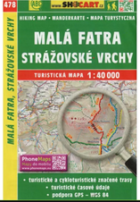
Malá Fatra, Strážovské vrchy 1: 40000

View Full-Size Image
ACTION PRICE
Product description
Map Malá Fatra, Strážovské vrchy 1: 40000
A double-sided, detailed map at a scale of 1:40 000 for hikers and cyclists. Region Malá Fatra and Strážov Hills Contains: * all marked hiking trails including kilometres, nature trails, cycle paths * Road network (main and secondary) with numbers of main roads, unmarked, paved, unpaved roads, footpaths * River network * Railway network * Practical information (springs, petrol stations, rest stops, accommodation, car parks, hospitals, airports, spas, holiday resorts, etc.) * cultural, historical and natural monuments, tourist attractions, protected areas, panoramic roads * contours * shaded elevation * forests * GPS support - WGS 84 Format: 107 x 164 mm Weight: 55 g Scale: 1:40 000
Parameters
Video
Question on product
Bargain packages
You can also find similar products here:
Your price: 6,30 €
7,00 €
Save 10 %

EXPRESS DELIVERY via GLS and Packeta
VERIFIED SHOP more than 12 years of skills
GUARANTEED the lowest prices
Výmena tovaru zdarma pre oblečenie a obuv nad 160 €
Pri objednávke oblečenia a obuvi, s hodnotou viac ako 160 € ti poskytneme výmenu tovaru zdarma a veľmi rýchlo.
CUSTOMER SERVICE we are here for you
Customer service we are here for you
Ohľadom tohto produktu ti poradí: Patrik 0917 225 882
You can also find similar products here:
Recently viewed
Malá Fatra, Strážovské vrchy 1: 40000
Map Malá Fatra, Strážovské vrchy 1: 40000
 7,00 €
6,30 €
Save 10 %
7,00 €
6,30 €
Save 10 %
7,00 €
6,30 €
Save 10 %
ACTION PRICE
Subscribe to our newsletter and keep up with the latest offers and trends
Five reasons to shop at ADAMSPORT.STORE
|
Express delivery |
Verified shop |
Guaranteed |
Customer service |
Our local store |


Contact us
Store adress:
Adam Sport, s.r.o.
Bystrická cesta 5649/4B
034 01
Ružomberok
Slovakia
adamsport@adamsport.store

VAT: 45881553
VAT ID: SK2023122321
Share your opinion with others
Add reply to comment: